login
You are not logged in.
search:
AMSER logo


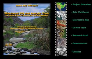
Title: NASA ARC Project: Web Based and Analytic Tools for Natural Habitat Conservation and Management
Url: http://map.sdsu.edu/arc/
Publisher: San Diego State University
Description: This project, a collaboration between NASA and San Diego State University, "seeks to enhance the utility of remote sensing data by developing Web-based data warehousing, on-line mapping tools and analytic functions." On this site, visitors will find a project overview that details goals, objectives, tasks, technical issues, and market phrasing to orient them to the project and its purpose. The Data Warehouse contains remote sensing metadata as well as boundary files and layers for download. The Interactive Map "allows dynamic representation of geographical information, which enhances the power of visual data communication, increases user interactivity, and improves the usefulness and value of the cartographic product." The section on On-Line tools contains a number of applications that allow for deeper image analysis including overlay, magnifiers, filtering, and comparison. Also, you can help the project out by filling out a brief questionnaire that will help them determine the direction of future research. This is a helpful resource for instructors in GIS courses generally, and especially for those using GIS in environmental sciences.
LC Classification: Geography. Anthropology. Recreation -- Geography (General) -- Philosophy. Relation to other topics. Methodology -- Special methods -- Geographic information systems
Geography. Anthropology. Recreation -- Geography (General) -- Philosophy. Relation to other topics. Methodology -- Special methods -- Remote sensing
Geography. Anthropology. Recreation -- Geography (General) -- Tables. Distances, geographical positions, etc. -- Global Positioning System
GEM Subject: Science -- Geology
Social studies -- Geography
Key Concept: Geography -- Geographic information systems (GIS)
Geography -- Global positioning systems (GPS)
Geography -- Remote sensing
Resource Type: Collection
Reference Material
Instructional Material
Instructional Material -- Instructor Guide/Manual
Format: Document -- HTML
Audience: Educator
Learner
Education Level: High School
Higher Education
Higher Education -- Undergraduate (Lower Division)
Higher Education -- Undergraduate (Upper Division)
Higher Education -- Technical Education (Upper Division)
Higher Education -- Technical Education (Lower Division)
Vocational/Professional Development Education
Language: English
Access Rights: Free access
Screenshot
Full Image
Source Type: ATE Center
Source: GeoTech Center
Full Record Views: 2
Resource URL Clicks: 6
Cumulative Rating: NOT YET RATED
Report a Problem with this Resource Record

Resource Comments

(no comments available yet for this resource)

user login
Username:
Password:
why log in?
Manage your resources
Save, organize, and share resources that you find.

Subscribe to bulletins
Automatically be notified about new resources that match your interests.

It's easy, fast, and FREE!
AMSER =
FREE ONLINE
RESOURCES
for the
CLASSROOM

Copyright 2024 Internet Scout Resource Metadata
Copyright 2024 Internet Scout
NSF NSDL University of Wisconsin Internet Scout
Leave Feedback
http://amser.org/