login
You are not logged in.
search:
AMSER logo


Title: Tectonics
Url: https://gis.lanecc.edu/modules/tectonics/
Creator: Benjamin, Jane
Songer, Lynn
Publisher: Lane Community College (Eugene, Or.)
Description:

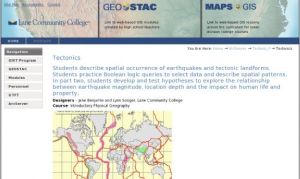
In this activity, developed by the Lane Community College Geo-STAC program​, students will "describe spatial occurrence of earthquakes and tectonic landforms. Students practice Boolean logic queries to select data and describe spatial patterns. In part two, students develop and test hypotheses to explore the relationship between earthquake magnitude, location depth and the impact on human life and property." This activity was created as part of the Introductory Physical Geography course. On the site, visitors will find a link to the student activity and teaching guide, as well as link to the web-based GIS map. This is an excellent activity for high school or early undergraduate students for hands-on work with GIS and coordinate systems.

LC Classification: Geography. Anthropology. Recreation -- Geography (General) -- Philosophy. Relation to other topics. Methodology -- Special methods -- Geographic information systems
Geography. Anthropology. Recreation -- Geography (General) -- Study and teaching. Research
Geography. Anthropology. Recreation -- Mathematical geography. Cartography -- Mathematical geography. Cartography -- Cartography -- Elementary map drawing and reading
Geography. Anthropology. Recreation -- Mathematical geography. Cartography -- Mathematical geography. Cartography -- Cartography -- Projection
Geography. Anthropology. Recreation -- Physical geography -- By region or country -- America -- North America -- United States
Science -- Geology -- Dynamic and structural geology -- Plate tectonics -- General works
Science -- Geology -- Dynamic and structural geology -- Volcanoes and earthquakes -- Earthquakes. Seismology
GEM Subject: Social studies
Social studies -- Geography
Social studies -- Instructional issues
Key Concept: Geography -- Cartography
Geography -- Earthquakes
Geography -- Geographic information systems (GIS)
Geography -- Plate tectonics
Geography -- Maps
Resource Type: Instructional Material
Assessment Material -- Test
Instructional Material -- Student Guide
Instructional Material -- Lesson/Lesson Plan
Instructional Material -- Instructor Guide/Manual
Format: Document -- DOC
Document -- HTML
Audience: Educator
Learner
Education Level: High School
Higher Education
Higher Education -- Undergraduate (Lower Division)
Higher Education -- Undergraduate (Upper Division)
Higher Education -- Technical Education (Upper Division)
Higher Education -- Technical Education (Lower Division)
Vocational/Professional Development Education
Language: English
Access Rights: Free access
Screenshot
Full Image
Source Type: ATE Project
Source: ATE Projects
Full Record Views: 18
Resource URL Clicks: 7
Cumulative Rating: NOT YET RATED
Report a Problem with this Resource Record

Resource Comments

(no comments available yet for this resource)

user login
Username:
Password:
why log in?
Manage your resources
Save, organize, and share resources that you find.

Subscribe to bulletins
Automatically be notified about new resources that match your interests.

It's easy, fast, and FREE!
AMSER =
FREE ONLINE
RESOURCES
for the
CLASSROOM

Copyright 2024 Internet Scout Resource Metadata
Copyright 2024 Internet Scout
NSF NSDL University of Wisconsin Internet Scout
Leave Feedback
http://amser.org/